Soil types and related properties of the Ahr catchment area's.
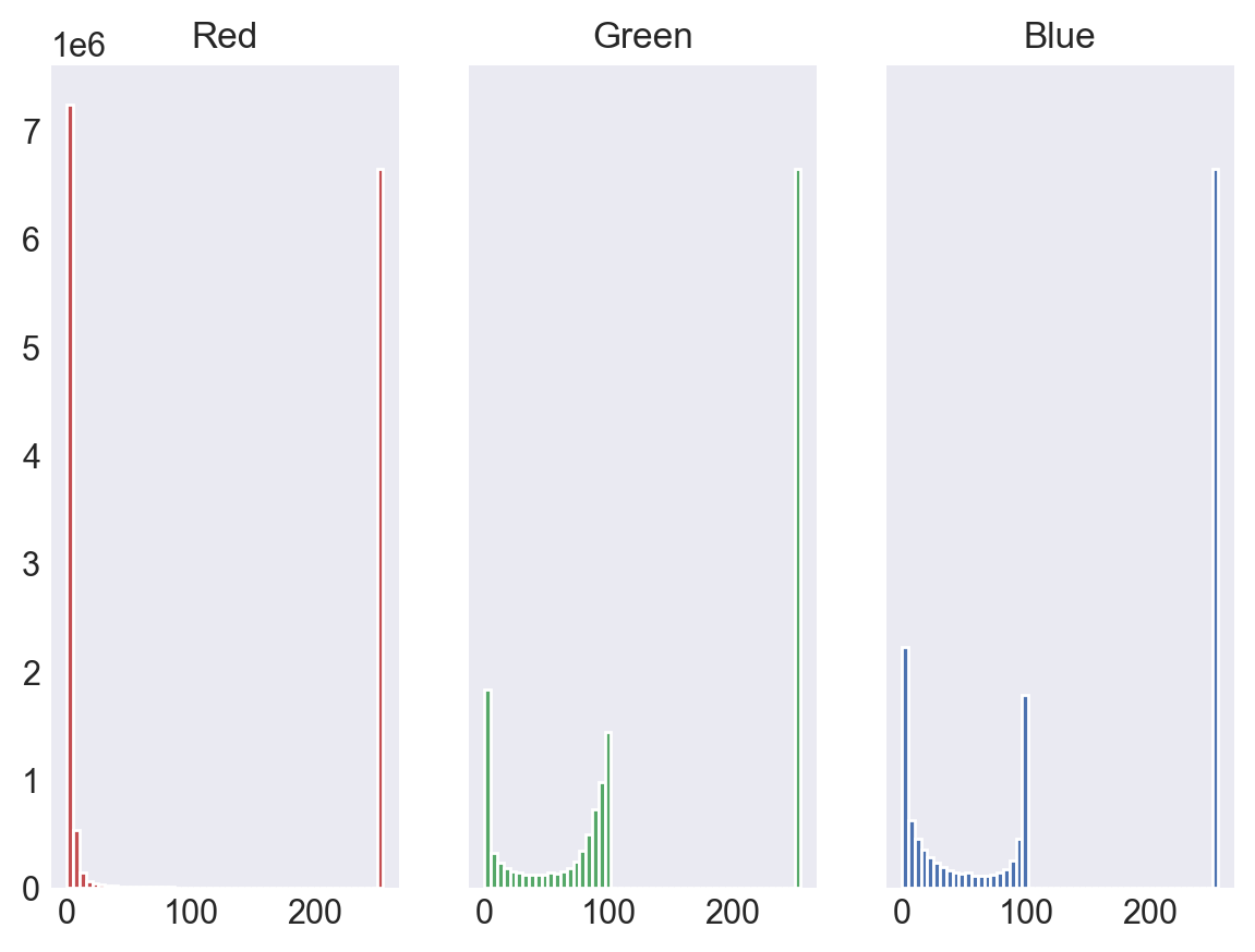
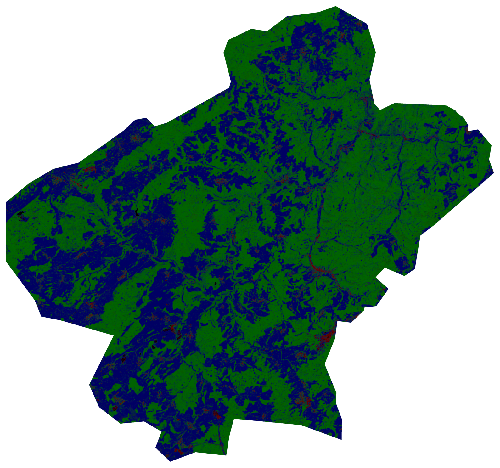
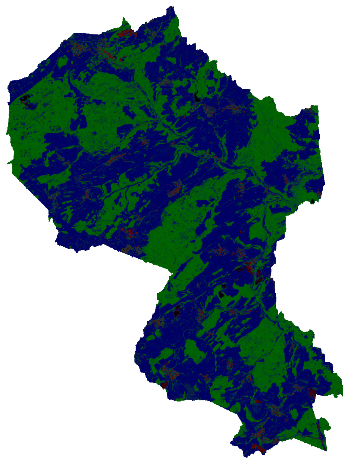
Land cover fraction map of Germany at 10m spatial resolution
based on Sentinel-1 and Sentinel-2 spectral temporal metrics.
PANGAEA, https://doi.org/10.1594/PANGAEA.920894
This enhanced set makes use of Sentinel-1 imagery, which reduces confusion of built-up features and seasonal soil-covered surfaces. Sentinel-2 Tasseled Cap Greenness is a more robust indicator for vegetation in temperate regions than the NDVI, which was used in the corresponding publication.
The file is in GeoTiff format and contains three bands:
- Band 1 - Fraction of built-up surfaces and infrastructure
- Band 2 - Fraction of woody vegetation
- Band 3 - Fraction of non-woody vegetation
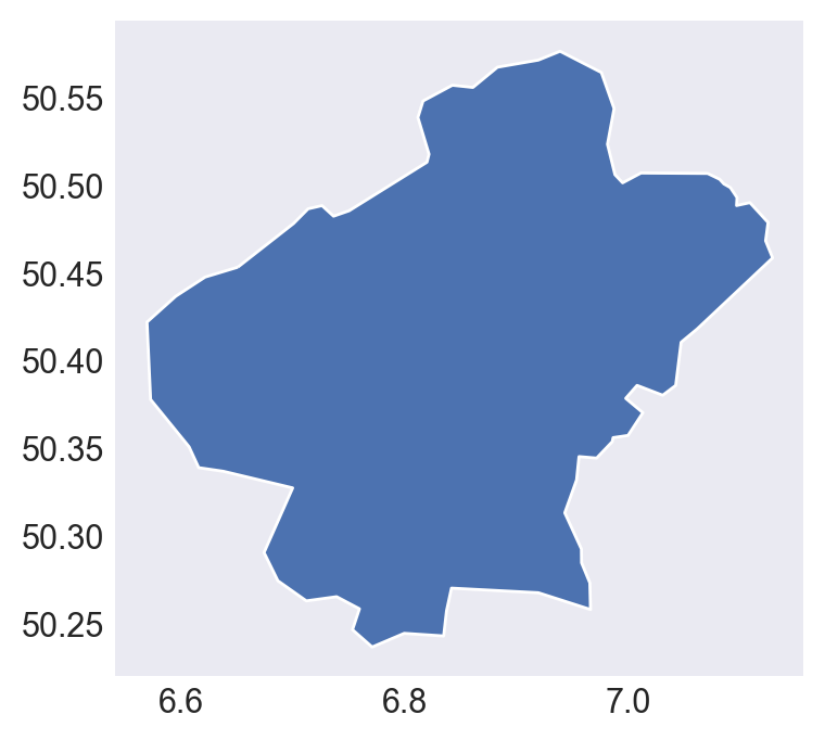
shapefile used to clip the big LC map:
this reproject in 6258 crs did not work: https://epsg.io/3035
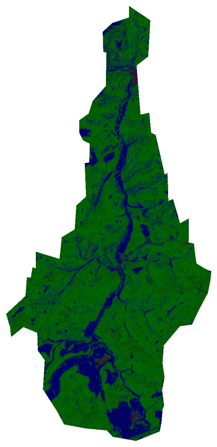
clip UpperAhr catchments
clip Weidenbach catchment
Forest area of 2015 vs 2019: impact on the different forest types
The forest types have been taken from the Corine land cover rasters.
Forest areas 2015 and Corine CLC
Forest areas 2019 and Corine CLC
Type of forest vs. forest area
Type of forest vs. the total area
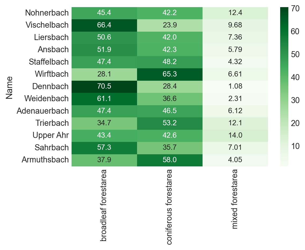
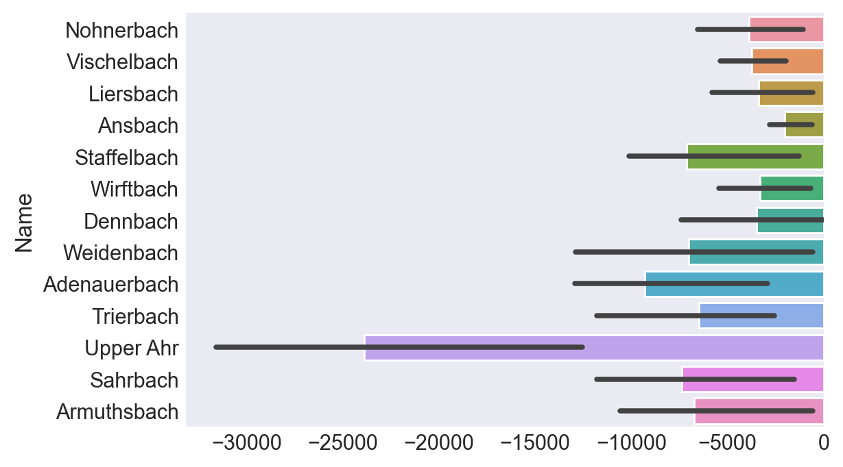
Forest areas anno 2015 by catchment
Percentage of non-forest areas per catchment:
Percentage of forested areas per catchment:
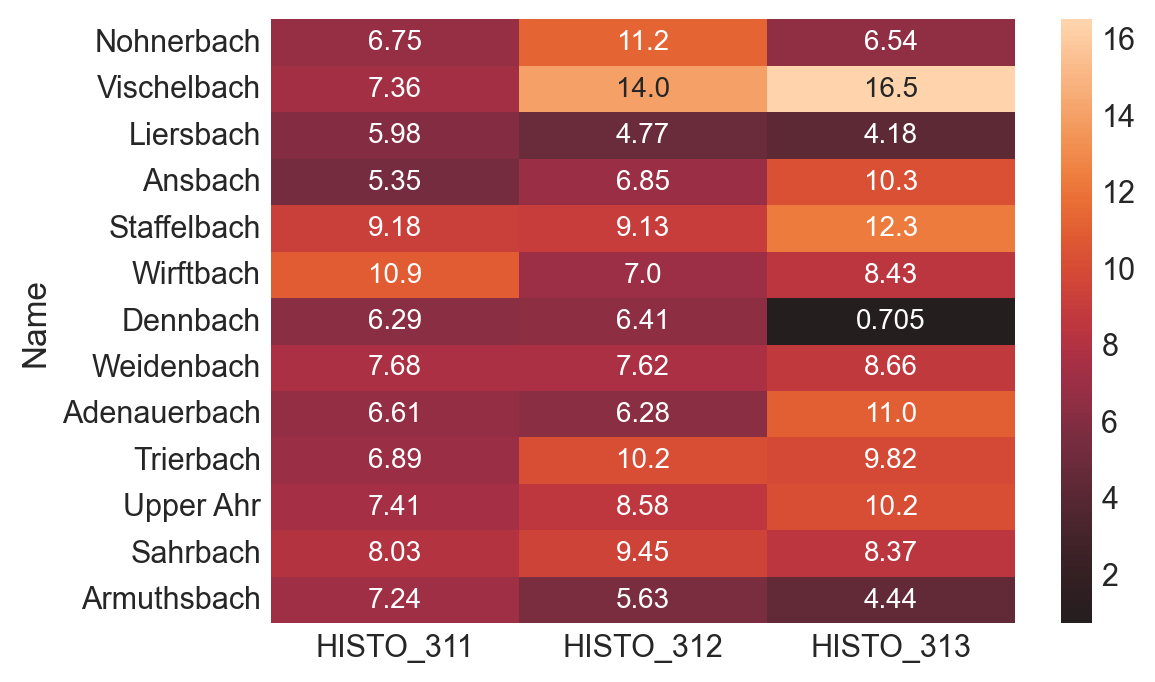
Percentage of forest type in forested areas per catchment:

Forest areas anno 2019 by catchment
Percentage of nodata areas per catchment:
Percentage of non-forest areas per catchment:
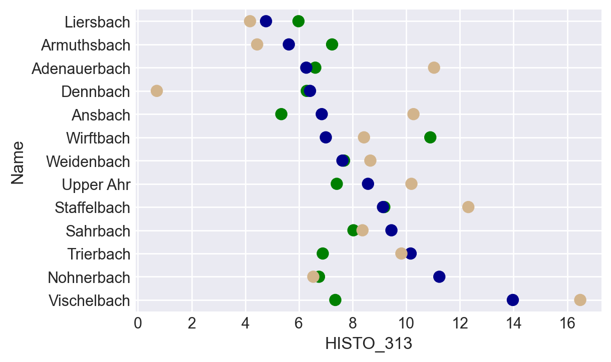
Percentage of forest type in forested areas per catchment:
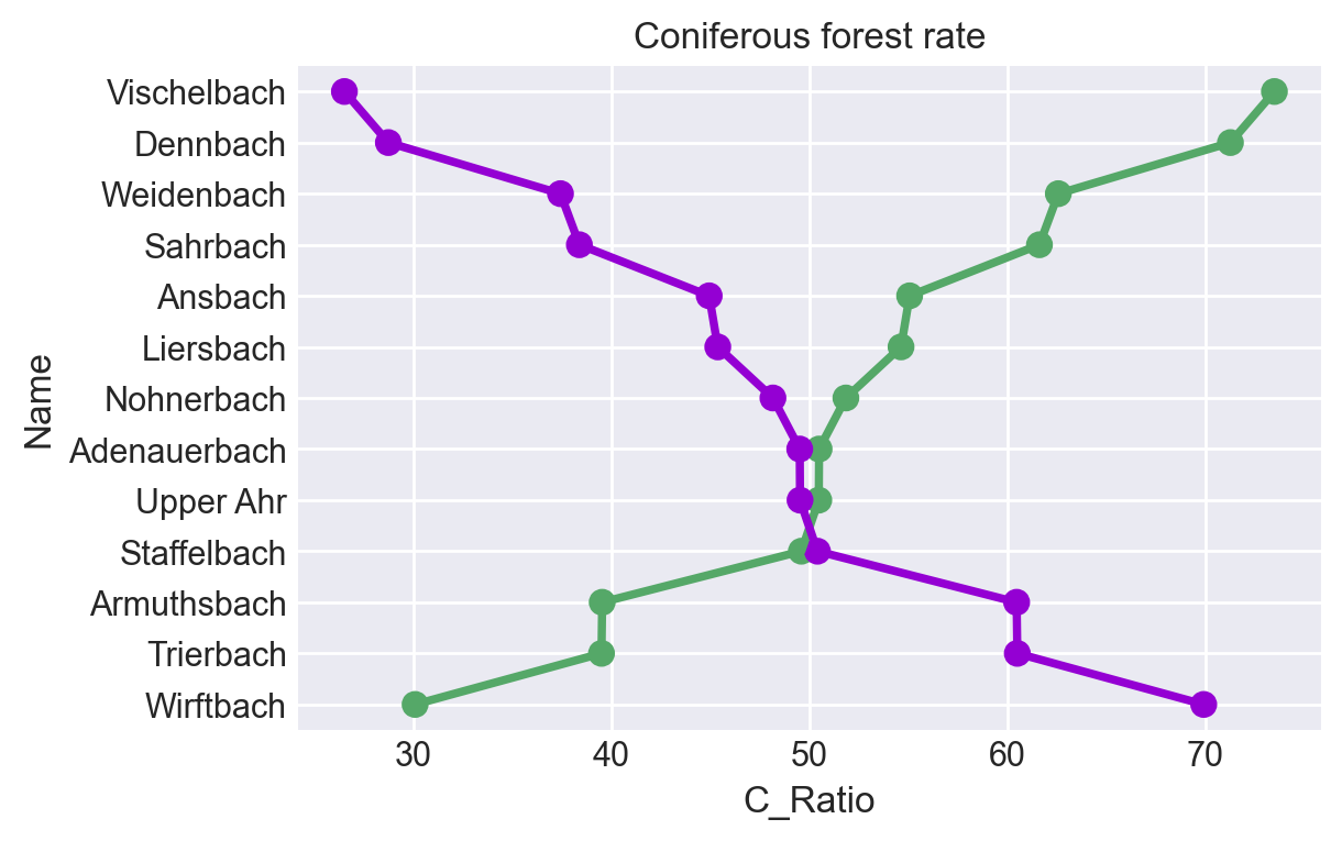
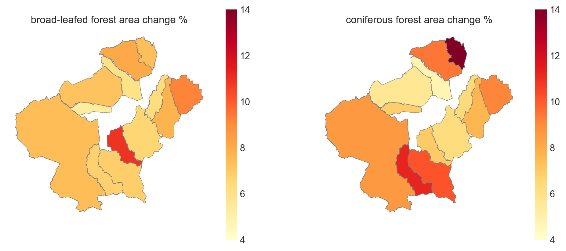
Coniferous forest change (loss) per forest type rate
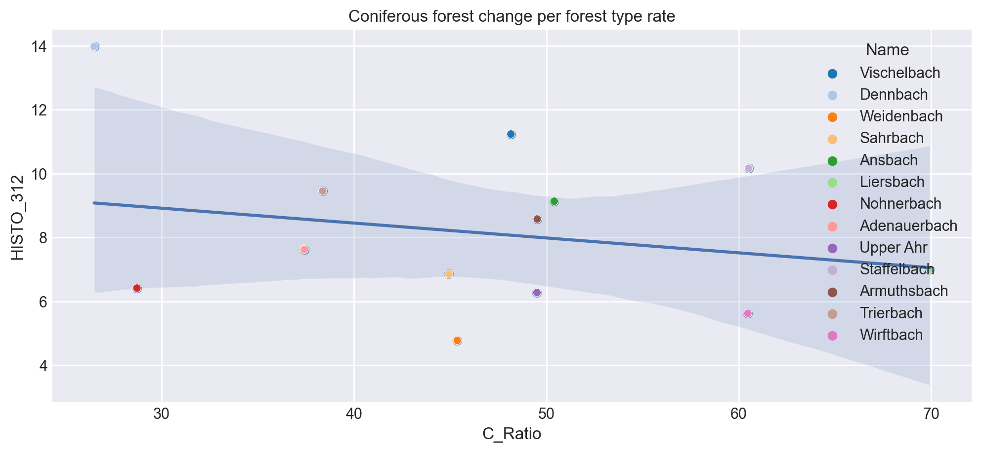
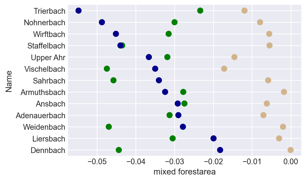
Percentage change per forest type over 4 years: identical forest area type
Map of % changes in broad-leafed and coniferous forest area over 4 years
This comparison has been made based on the respective area's of the same forest type, not the sum of the forested area.
Change over forest types in absolute numbers:
Percentage change per forest type over 4 years: complete forest area
Rheinland-Pfalz total area: 19858 km². In 2018, forest area for Rheinland-Pfalz was 7890 square kilometres.
calculate some percentages
Groundwater classes of BK50
Rather little data here...
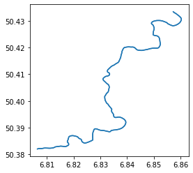
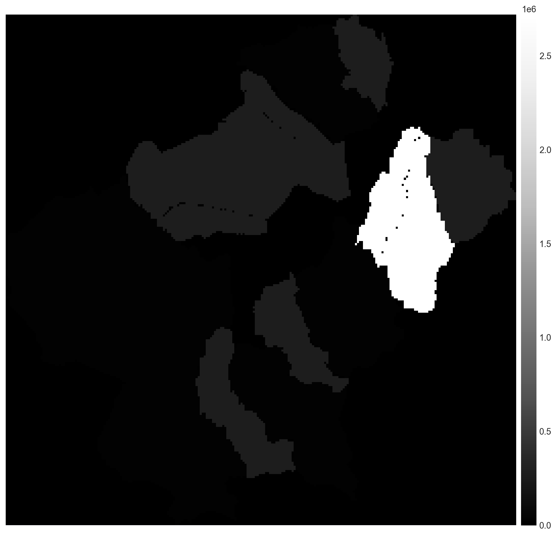
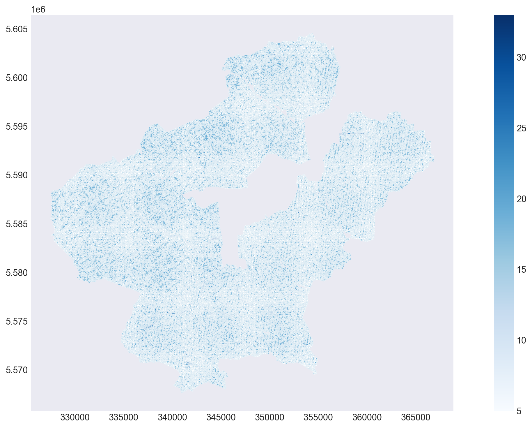
Mid Ahr basins streamcodes.tif
| Bezeichnung | sehr flach bis flach | mittel | tief | sehr tief | äußerst tief |
|---|---|---|---|---|---|
| Mittlerer Schwankungsbereich in dm unter GOF | 0 bis 4 | 4 bis 8 | 8 bis 13 | 13 bis 20 | über 20 |
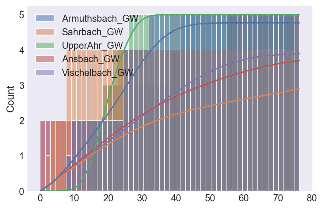
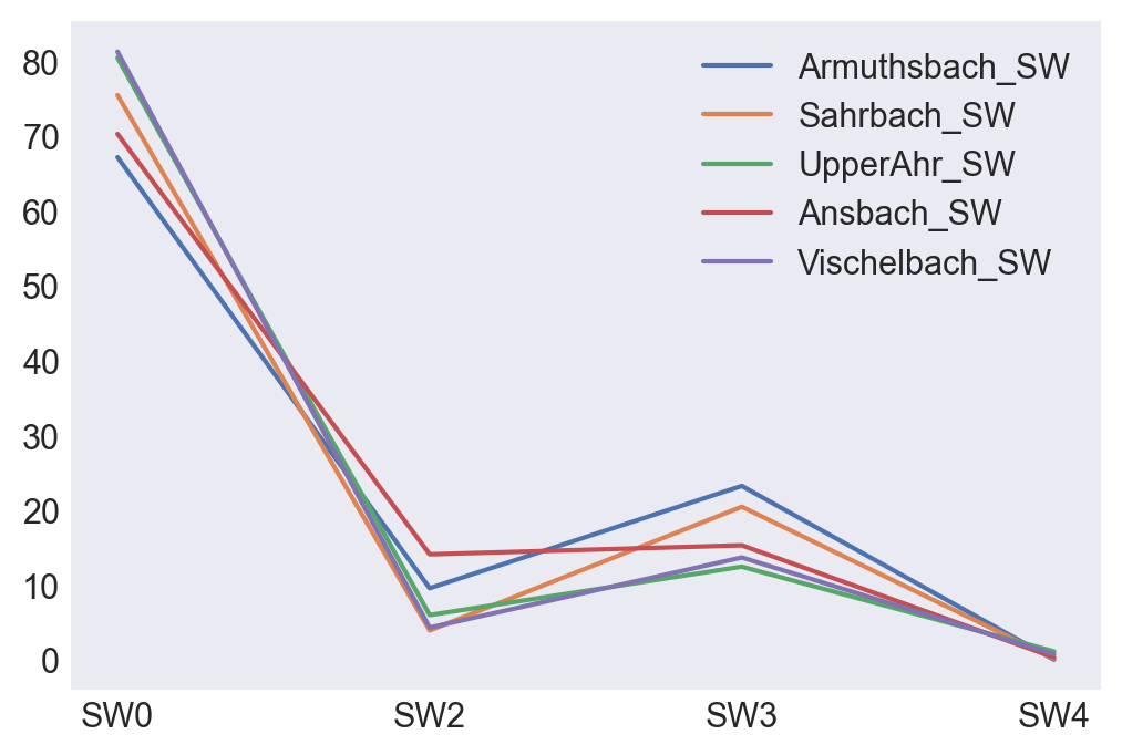
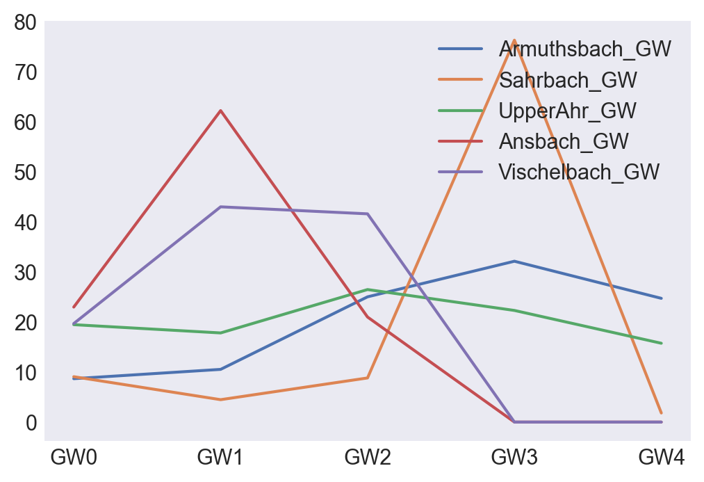
The cumulative plots starts with the most shallow soils. The Upper Ahr area's have the the most time lag, but their increase it the most sharp.
Armuthsbach might be a good precursor for the reaction of the Upper Ahr area's in terms of rainfall runoff.
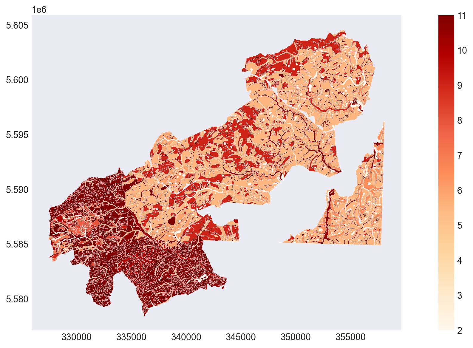
Soil types classified into 5 groups
This classification into only 5 groups is rather coarse. A higher class number means soils with lower infiltration rates.
Sand
lehmiger Sand
sandiger Schluffstark sandiger Lehm
lehmiger Schluff
sandiger Lehmschluffiger Lehm
Lehmschluffig-toniger Lehm
toniger Lehm
Ton
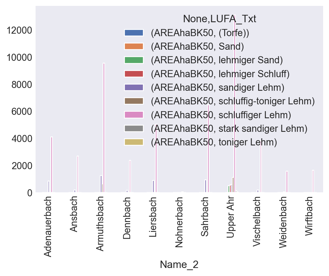
I selected only the area properties of the NRW-provided db. which are located within the RLP-catchments, for creating the following shapefile.
sBDA_txt : BDA KA5-Text der 'synthetischen' Bodenart
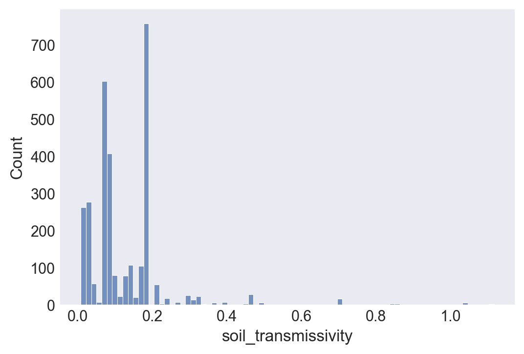
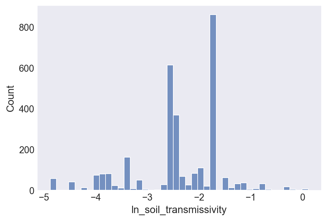
I saved the logar. of the soil transmiss. to a file so I can rasterize it later, in order to calculate a SWI-raster from the TWI- raster.
CRSError: The EPSG code is unknown. PROJ: proj_create_from_database: C:\Program Files\PostgreSQL\14\share\contrib\postgis-3.1\proj\proj.db lacks DATABASE.LAYOUT.VERSION.MAJOR / DATABASE.LAYOUT.VERSION.MINOR metadata. It comes from another PROJ installation. https://github.com/rasterio/rasterio/issues/2103
Nutzbare Feldkapazität nFK
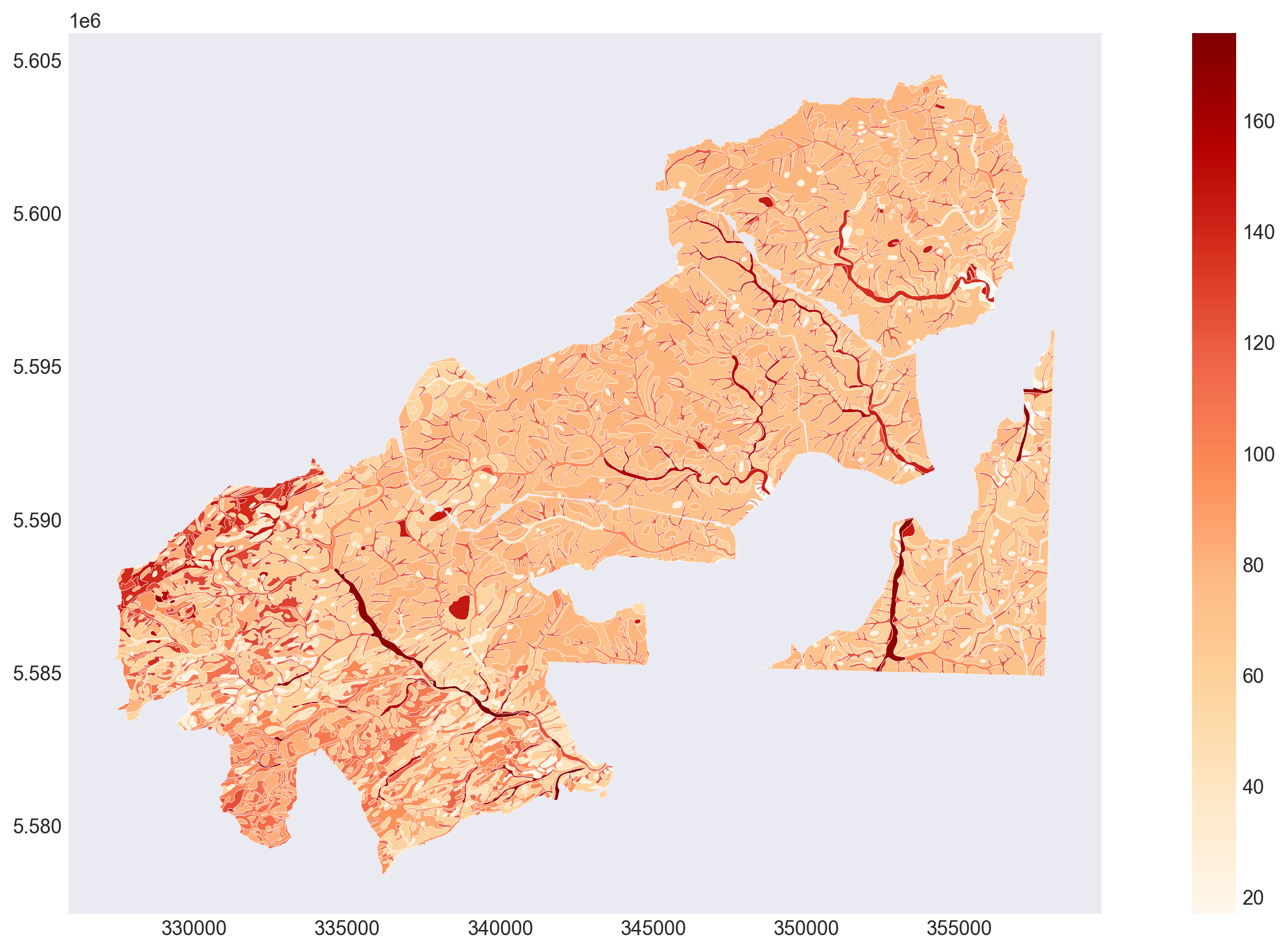
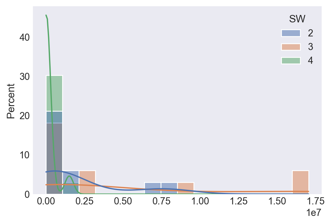
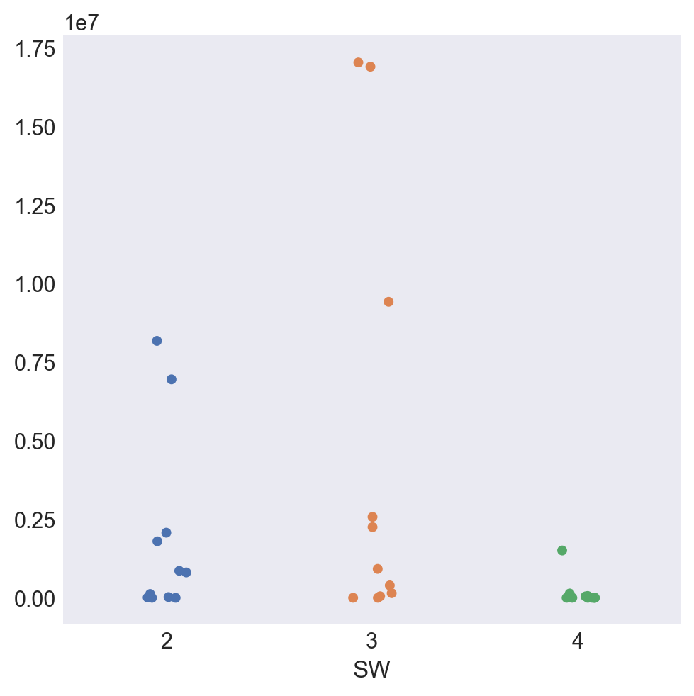
gesättigte Wasserleitfähigkeit im 2-Meter-Raum $k_f$
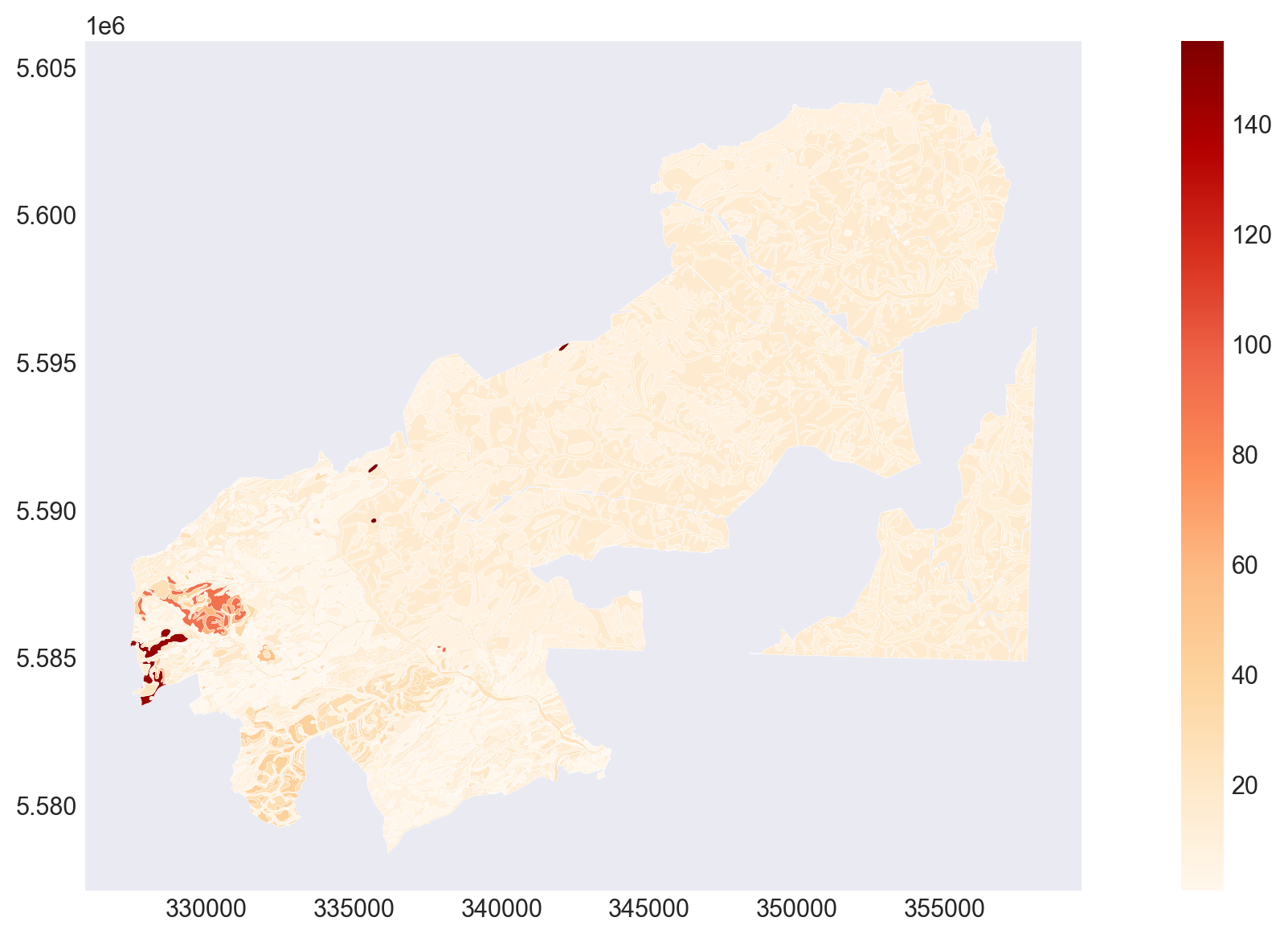
Gesamtfilterfähigkeit im 2-Meter-Raum
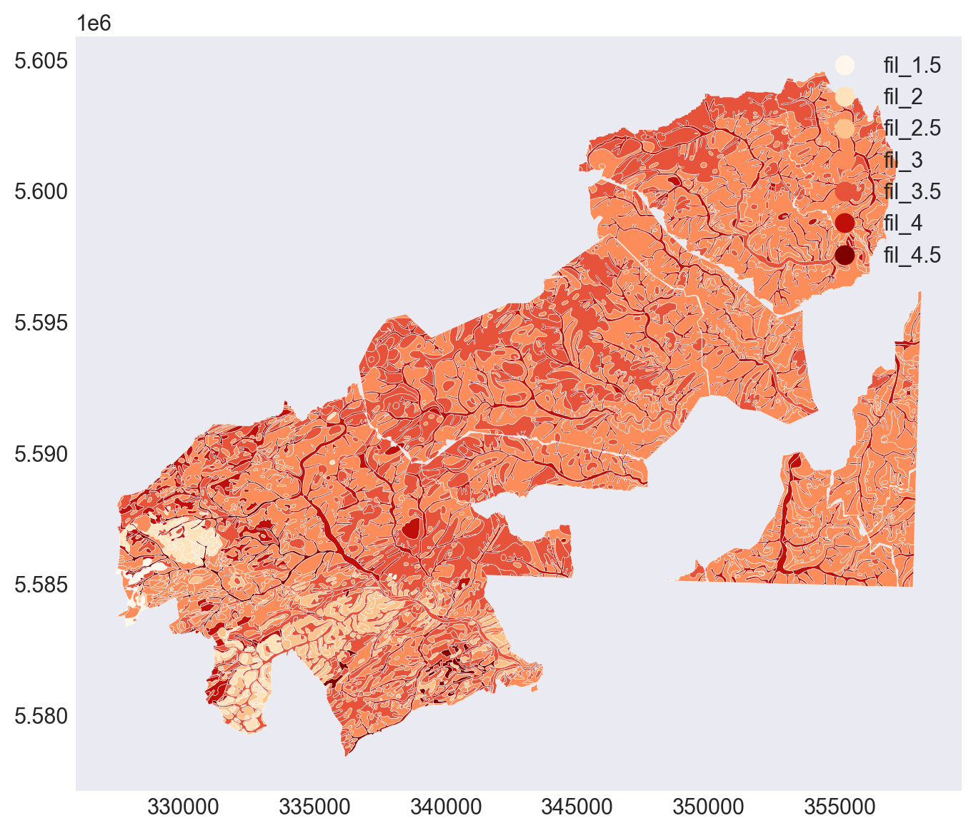
Durchwurzelungstiefe
LUFA soil group
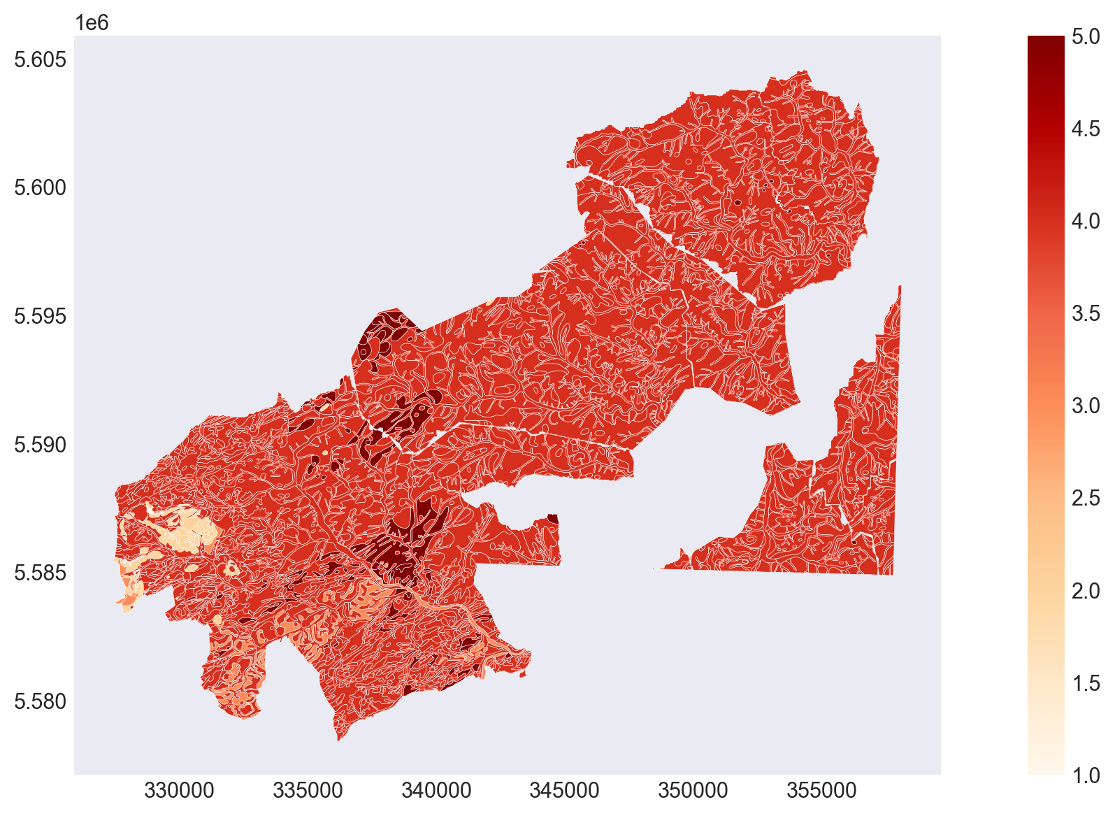
Grouping into the 5 classes.
Presence of group 5 neutralizes the group 3:
Applying the weights on the soil classes
Imperviousness burden: class 5 and 4 combined
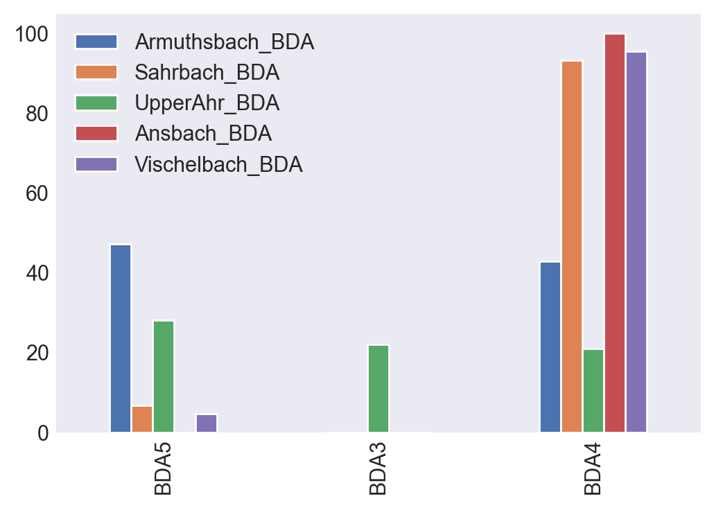
Grouping into specific soil type classes.
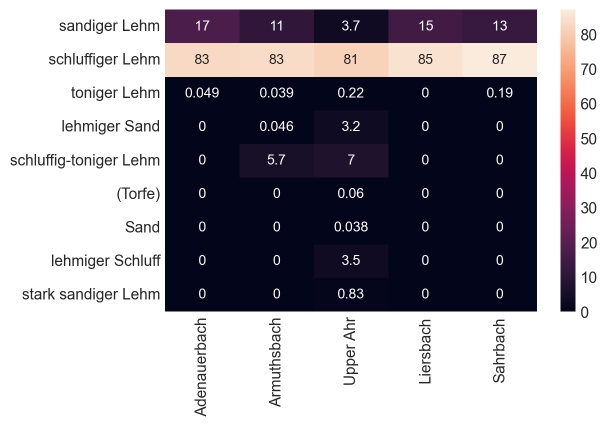
we try to link them to their infiltration rate... but mind that the German and US soil type classes do not overlap nicely.
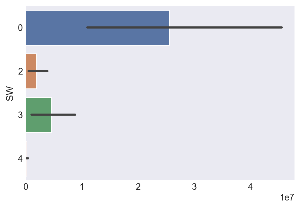
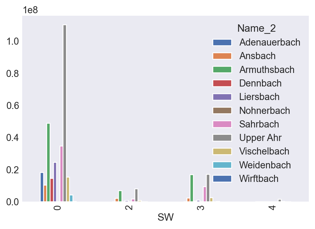
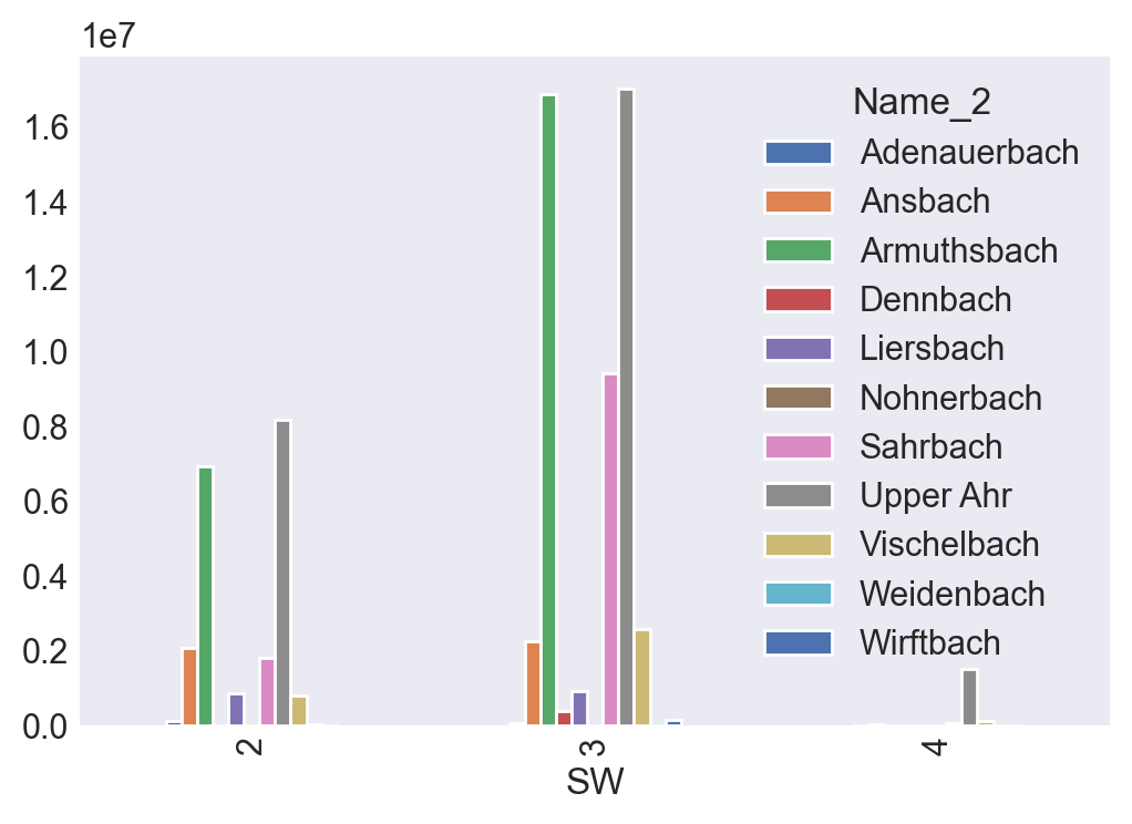
The area for the Wirftbach might be an error.
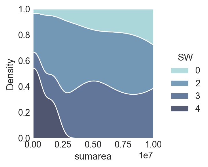
Calculate the total area per basin
Calculate the surface area per soiltype
We apply a dict to get the percentages
A more specific soil type classification per basin
designing a hazard value for area and infiltration inhibition:
Infiltration rates
The infiltration rates decay exponentially over time to a minimum value, as long as there is a surplus of rain water.
ha = 0.01 km² => hm² l / m² => hm² 10000 l / hm² => 10 m³
For those area's that have been classified: the volume of water that can be infiltrated by the basin, for the 1st hour:
Horton’s Equation for infiltration decay
Horton's model is empirical and is perhaps the best known of the infiltration equations. Many hydrologists have a "feel" for the best values of its three parameters despite the lack of published information.
The model gives infiltration capacity as a function of time as:

Where:
Fp = infiltration rate into soil, in./hr (mm/hr)
Fc = minimum or asymtopic value of Fp, in./hr (mm/hr)
Fo = maximum or initial value of Fp, in./hr (mm/hr)
t = time from beginning of storm, sec
k = decay coefficient, 1/sec
This equation describes the familiar exponential decay of infiltration capacity evident during heavy storms. However, the program uses the integrated form to avoid an unwanted reduction in infiltration capacity during periods of light rainfall.
Soils close to saturation:
Choose value close to saturated hydraulic conductivity
Values of Horton Equation parameters suggested by Akan (1993):
Values suggested by Akan (1993):
Maximum (Initial) Infiltration Capacity, F0
| Soil Type | (in/hr) | (mm/hr) |
|---|---|---|
| Dry sandy soils with little or no vegetation | 5.0 | 127 |
| Dry loam soils with little or no vegetation | 3.0 | 76.2 |
| Dry clay soils with little or no vegetation | 1.0 | 25.4 |
| Dry sandy soils with dense vegetation | 10.0 | 254 |
| Dry loam soils with dense vegetation | 6.0 | 152 |
| Dry clay soils with dense vegetation | 2.0 | 51 |
| Moist sandy soils with little or no vegetation | 1.7 | 43 |
| Moist loam soils with little or no vegetation | 1.0 | 25 |
| Moist clay soils with little or no vegetation | 0.3 | 7.6 |
| Moist sandy soils with dense vegetation | 3.3 | 84 |
| Moist loam soils with dense vegetation | 2.0 | 5.1 |
| Moist clay soils with dense or no vegetation | 0.7 | 18 |
Minimum (Asymptotic) Infiltration Capacity, $Fc$
| Soil Type | (in/hr) | (mm/hr) |
|---|---|---|
| Clay loam, silty clay loam, sandy clay, silty clay, clay | 0.00 - 0.05 | 0.00 - 1.3 |
| Sandy clay loam | 0.05 - 0.15 | 1.3 - 3.8 |
| Silt loam, loam | 0.15 - 0.30 | 3.8 – 7.6 |
| Sand, loamy sand, sandy loam | 0.30 - 0.45 | 7.6 – 11.4 |
The minimum (asymptotic) infiltration rate is often close to the saturated hydraulic conductivity of the soil.
I found this value of Moist loam soils with dense vegetation 5.1 surprisingly very low. So I searched for recent studies about these parameters.
Dynamic study of infiltration rate for soils with varying degrees of degradation by water erosion International Soil and Water Conservation Research Volume 7, Issue 2, June 2019, Pages 167-175. https://doi.org/10.1016/j.iswcr.2018.12.005
Empirical parameters for infiltration decay in moist loamy soils
For F0 I chose a Minimum (Asymptotic) Infiltration value between those of moist loamy soils $5$ and moist clay soils $18$: 12 mm/hour. HR, high rainfall intensity (120 mm/h); LR, low rainfall intensity (60 mm/h)
$$Fp_{LR}=F_c + (F_0 - F_c )\cdot e^{-k_{LR}\cdot(t-T_r)}$$
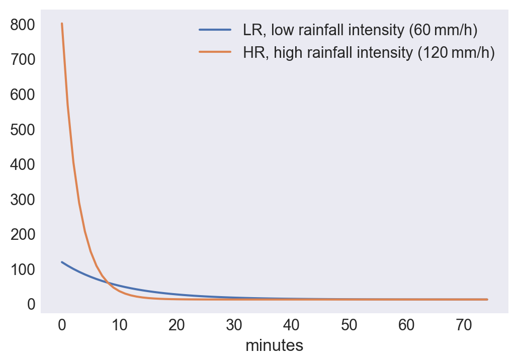
Conclusion: moist loamy soils are quickly saturated due to sharp declining infiltration rate.
SoilDic= {"Sand" : "Sand",
"lehmiger Sand" :"Loamy Sand",
"lehmiger Schluff":"Silt Loam" ,
"sandiger Lehm": "Fine Sandy Loam",
"schluffig-toniger Lehm":"Silty Clay Loam" ,
"schluffiger Lehm":"Very Fine Sandy Loam",
"stark sandiger Lehm":"Sandy Loam",
"toniger Lehm":"Clay Loam"}
TWI Ahr: topographic wetness index
This index is unfiltered. Some authors write that applying a 3x3 filter (on a very high resolution DEM) produces better results.
TWI in relation with soil depth
TWI $unitless$ divided by soil depth in dm. The standard TI takes the form: $TI=ln(A_s/tan(\beta))$
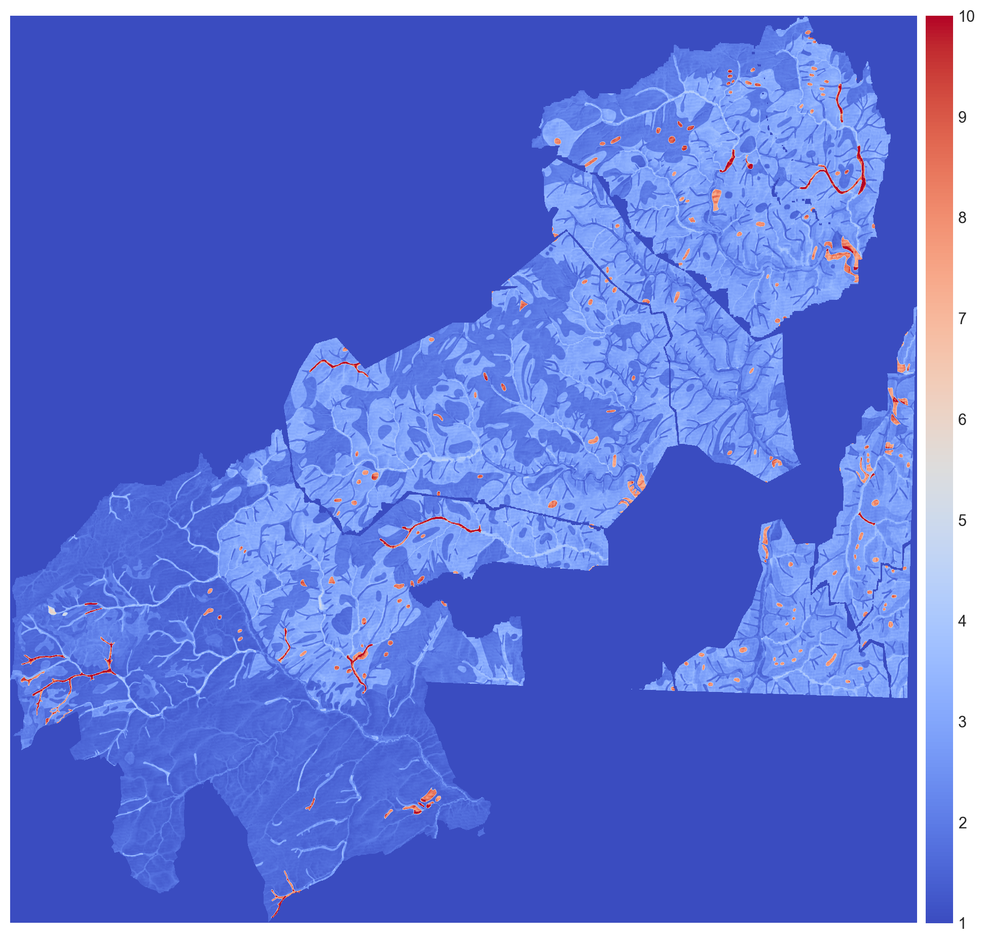
The soil-topographic wetness index (STI), which extends the purely topography-based TWI by accounting for spatial variation in hydrologically relevant soil properties: $STI=ln(A_s/(T \cdot tan(\beta))$
Soil compatibility map NRW for European spruce
This map is for NRW areal, but it holds area's of RLP also.
The general incompatibility of many of current trees is in line with the big outfall of damaged of death spruce of the last years.
- red: high risks for drought or insect damage
- yellow: medium risks for drought or insect damage
State of the Forest report of NRW 2021
In February 2022 I found this report Waldzustandsbericht_NRW_2021_Langfassung.pdf that is in line with my findings:
- Since 2018 the destruction of needleleaf trees has multiplied
- The European spruce beetle is the main culprit, but
- The placement of most tree species is not according to contemporary knowledge and guidelines of Forestrenewal, and local soiltype compatibility for a specific kind of tree species is poor in elevations above 300 m.